






















1910 Sanborn Fire Insurance map details are revealing

The Ohio History Connection recently featured the digitization of Sanborn Fire Insurance maps for the Open Access Kent State collection and invited viewers to look for their town's map.
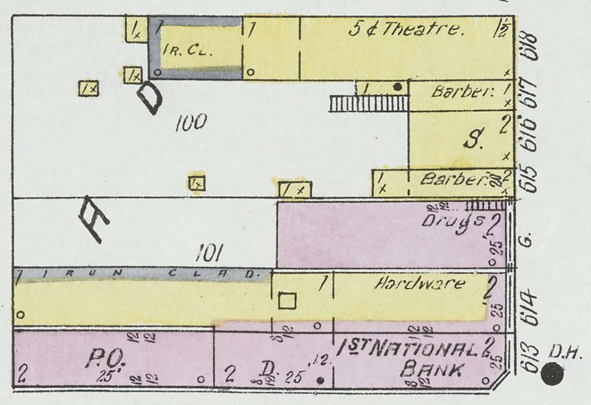
Bluffton's 1910 map shows many familiar locations but also reveals how things have changed in the intervening 111 years. For example, a movie was 5 cents. In the event of a fire, the town hall bell was rung. The map shows which buildings had hot water and heat--and whether that heat came from a stove or furnace. You'll also find pool rooms, a cobbler, harness shops, the Hotel Russell, The Bluffton Cream Separator Company, an electric railroad depot and other vanished entities.
1910 Bluffton Sanborn Fire Insurance Map at Open Access Kent State.
Stories Posted This Week
Thursday, October 15, 2026
- DeWine announces $200M Rural Health Transformation program award
- Herb program with Marge Lafollette, Oct. 15
- Prairie seeding activity at Bluffton University, October 24
- Food for thought: Choline for the brain
- Results for 5K on October 2, Bluffton University Homecoming event
- 15 minutes with Sherry Miller, senior center activities coordinator
Wednesday, October 14, 2026
- Ada Icon headlines, October 14
- CANCELLED Main St. closure on October 15
- Frederick Clyde Warren founded True-2-Form Plastics
- October 15 Bluffton Schools athletics lineup, streaming
- Pirate boys soccer beats Wapak in regular season finale
- Pirate girls soccer defeats Liberty Center
- Mennonite pastor to explore ‘good news’ in creation
- Bluffton University earns recognition in U.S. News & World Report rankings
- Obituary for Deborah "Debbie" Welch, 74
- Spirits and exorcism presentation during University Spiritual Life Week Forum
- Dodging bullets: Bluffton oral history 90+ years after Dillinger robbery
- Nora Matthews named BHS Student of the Month for September 2026
- ICAPP analysis on charter status and local autonomy
Tuesday, October 13, 2026
- Ada Icon headlines, October 13
- Bluffton area Women in Business meeting October 15
- Leo club glasses collection
- Night at the (Swiss Historical) Museum, October 24
- Woodcarving ornament workshop at Swiss Heritage Center
- Barefoot nature walks at the Nature Preserve
- Pirate volleyball seeded 4th
- Beavers sports roundup, October 6-11
- Bluffton leaf pickup scheduled for last week of October
- Pirate boys soccer shuts out Bellefontaine
- Watch an after school movie at the Bluffton Public Library
- Dunlap awarded OSBA humanitarian award